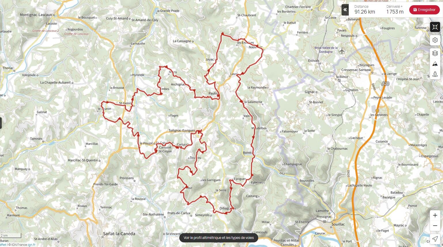
GR® de Pays - Boucle des Coteaux
Country Hiking Trail ("Grande Randonnéé®")
in Salignac-Eyvigues
92.7
km
Loop
- 1551 meters of difference in height
-
- Start altitude : 133 m
- End altitude : 140 m
- Maximum altitude : 339 m
- Minimum altitude : 133 m
- Total positive elevation : 1551 m
- Total negative elevation : -1544 m
- Max positive elevation : 159 m
- Min positive elevation : -151 m